
Carmel ZIP Code Coverage
The core Carmel ZIP code directory has two standard delivery areas and a Carmel post-office box pattern. City legal notices also connect two south-edge Indianapolis-numbered codes with current Carmel notices. They require address-level checks. Neighboring codes may appear because a parcel is affected by a planning notice, not because the whole postal area lies inside Carmel.
| ZIP Code | Areas Covered | Post Office | Notes |
|---|---|---|---|
| 46032 | Central, west, and older Carmel pattern | Carmel Main Post Office | Standard Carmel delivery; verify each address |
| 46033 | East and southeast Carmel pattern | Carmel postal service area | Grouped with current Carmel notices |
| 46082 | Carmel PO box or special postal pattern | Carmel label | Not proof of a physical parcel |
| 46280 | South-edge, Carmel-linked label | Verify with USPS | Address-specific, not a full city polygon |
| 46290 | South-edge, Carmel-linked label | Verify with USPS | Address-specific, not a full city polygon |
The Carmel publication chart groups 46032, 46033, 46280, and 46290 with current Carmel notices. It separately labels 46074 for Westfield, 46077 for Zionsville, 46240 and 46260 for North Indy, and 46268 for Indianapolis. The chart routes legal notices. It is not an exact postal boundary map.
Three Core Carmel ZIP Codes
Use 46032 and 46033 as the standard Carmel delivery patterns, then verify the full address. The Carmel Main Post Office serves the area from 275 Medical Drive and publishes its current retail and contact details through USPS. The official location page lists 317-846-2489. Hours can change, so check the live listing before a visit.
The 46082 label needs more care. Research found it associated with Carmel post-office box handling rather than a normal physical-address inference. A post-office box can receive mail for someone whose parcel or residence is elsewhere. Search the street address separately in county property records.
Check the Carmel Main Post Office listing for current service details.
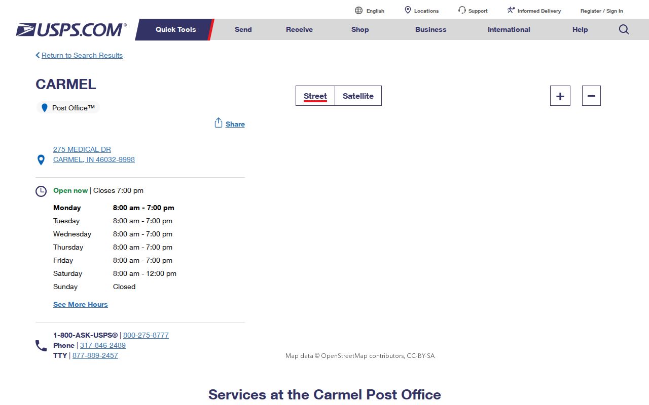
The captured USPS page supplies the official postal-office channel behind the core Carmel ZIP code area.
Carmel ZIP Codes at Edges
The 46280 and 46290 codes are the clearest local boundary quirk. Carmel's own legal-notice chart places them in its current-notice group, yet their Indianapolis-style numbers and south-edge context make a city-name guess unreliable. Verify the street through USPS, then check its parcel against Carmel and Hamilton County maps.
Adjacent 46074, 46077, 46240, 46260, and 46268 records may still appear in Carmel-area planning or parcel research. The chart assigns those labels to Westfield, Zionsville, North Indy, or Indianapolis publication groups. An affected neighbor parcel does not convert the full ZIP into Carmel.
Boundary check. Postal delivery, municipal government, taxing jurisdiction, and a planning-notice area can describe four different geographies.
Verify a Carmel ZIP Address
The USPS ZIP Lookup is the authoritative postal check. Its three modes answer different questions. A result standardizes delivery geography. It does not establish that a named person occupies the address, that a parcel lies within Carmel, or that a business is physically present there.
| USPS mode | Fields | Best use |
|---|---|---|
| By Address | Company optional; street required; unit, city, state, ZIP | Standardize one complete delivery address |
| By City and State | City and state required | List postal codes associated with a city label |
| Cities by ZIP | ZIP required | Check the city labels accepted for one code |
Enter a unit when known. Condominiums may share a base street address while county records use separate parcels. After USPS returns a label, carry the normalized street and unit into the parcel search. Keep the USPS result date because route and label data can change.
Find Carmel Residents by ZIP
A ZIP code directory narrows the field but does not produce a resident roll. Hamilton County GIS has Owner ZIP and Location ZIP fields for parcel context. The assessor screen instead accepts a duplicate number, state parcel number, property address, or mailing address. The voter portal requires a person's name, date of birth, and county, not a public ZIP-wide query.
- Verify the full street address through USPS and save the standardized ZIP.
- Open Hamilton GIS and use the location ZIP only to find parcel context. Paginate broad results.
- Select the parcel in Hamilton Property Reports and read ownership, mailing address, parcel ID, and transfer data.
- Use person-specific voter or court searches only after a name and county are known.
- Confirm city jurisdiction with Carmel maps instead of assuming it from the postal label.
INBiz, professional license verification, and unclaimed property can accept a city or ZIP for their own filing types. Their results are entity, license, or claim leads, not lists of everyone living in that area. Once the code narrows to a street, the Carmel street directory supplies the address-level workflow.
Carmel ZIP Address Meanings
Three address fields must stay separate. A situs or location address is the physical parcel. A mailing address receives tax or owner correspondence and can be a post-office box or another city. A legal description identifies land through a plat, lot, block, section, or metes-and-bounds description. The legal description can remain stable after a street label changes.
- ZIP
- A five-digit USPS delivery code, not a city boundary.
- ZIP+4
- A more specific delivery segment added to the five-digit code.
- PO-box ZIP
- A code used for post-office box delivery rather than a street parcel.
- Unique ZIP
- A code assigned for special or high-volume postal handling.
- Carrier route
- A mail delivery path within a ZIP, not a resident or parcel boundary.
Hamilton GIS also holds parcel numbers, subdivision, block, lot, tax district, owner ZIP, and location ZIP. Use those fields to join geography. Do not turn the owner mailing ZIP into a claim that the owner lives on the parcel.
Carmel ZIP Code Corridors
Carmel covers almost 50 square miles. The city's geography places US-421 on the west, US-31 through the middle, and Keystone Avenue to the east. Those corridors help orient an unfamiliar street across the broad 46032 and 46033 patterns. They do not replace a parcel map.
Older records add more mismatch. Carmel began as Bethlehem, and annexation and development changed the city around older roads, plats, and township labels. No official complete street-renumbering or annexation-to-address crosswalk was located. For an old address, use historical plats, city planning maps, the County Surveyor, deeds, and directory-era spelling rather than forcing it into a current ZIP code.
Note: A current ZIP should never be added to an old directory entry unless another source confirms the address conversion.
Carmel ZIP Numbers Need Context
Census QuickFacts reports 99,757 Carmel residents in the 2020 Census and a July 2025 estimate of 105,634. Those are city figures, not the sum of postal codes. Census ZIP Code Tabulation Areas, called ZCTAs, are statistical approximations. They can differ from current postal routes and may treat post-office box patterns in special ways.
Do not divide the city estimate among ZIPs without a cited dataset and method. A ZIP-wide parcel count is also not a resident count because condos, vacant land, businesses, common areas, and mailing addresses affect the rows. Use ZIP statistics for context and person-specific official records for identity.
Carmel ZIP Codes Versus Limits
USPS designs ZIP codes to move mail. Carmel sets a municipal boundary, and Hamilton County assigns parcel and tax geography. A physical parcel may have a surprising postal city or edge code. The reverse is also true: a Carmel mailing label does not guarantee that a property lies inside city limits.
Confirm four items in order: USPS delivery label, parcel location, municipal map, and record custodian. For voting, use the Indiana Voter Portal and County Election Office. For deeds and tax data, use Hamilton County. For planning and zoning, use Carmel only when the parcel is within the city's jurisdiction. This check prevents an innocent postal shortcut from becoming a false statement about a resident.
Privacy limit. A ZIP code is a broad research filter. Never use parcel or personal records to stalk, harass, threaten, or harm someone.